A&P Instrument provides 2D and 3D LiDAR based on ToF, FMCW, and FLASH technologies to meet the needs of mobile robots and AI for various applications. At the same time, we also offer a Localization Computation Unit that delivers continuous and stable pose information, assist agile development for a wide range of mobile robotic systems in faster way.
Robooster - Assist in Development of Mobile Robot Systems in faster way
Powered by Robooster’s proprietary multi-sensor time synchronization architecture and multi-source data fusion technology, we offer modular positioning solutions for diverse application scenarios, including:
- •LCU (Localization & Computing Unit): A multi-source fusion positioning module with pose data output
- •NIPC (Navigation Industrial PC): A series of open-source industrial computers for specialized navigation applications
- •SLAM-DP Development Platform: A plug-and-play, spatiotemporal fusion platform for agile development
OLEI Lasers – 2D and 3D ToF LiDAR
OLEI Lasers provides 1D, 2D, and 3D LiDAR for navigation, positioning, and obstacle avoidance in industrial and commercial mobile robots.
LightIC – FMCW 3D LiDAR
Photonics integration technology dedicated to the R&D and production of LiDAR chips and systems based on silicon photonics technology. With proprietary intellectual property, LightIC focuses on the development and mass production of next-generation FMCW LiDAR.
ToFFuture – Flash 3D LiDAR
ToFFuture's Flash LiDAR boasts long-range measurement capabilities, strong anti-interference performance, and design for mass production, enabling more efficient perception for industries such as vehicles, robots, IoT, and security.

Sino-German Robooster Intelligent Technology Co. Ltd (SGR)
Robooster was founded by PhD graduated from Germany in the field of robotics and navigation positioning in 2015. Adhering to the craftsmanship spirit of "Rigor, Patience, Professional, Continuous Improvement", Robooster aims to become a leading global provider of all scenario positioning solutions with the vision of "Find a Way for AI". The team has been deeply involved in mobile robots and autonomous mobile solutions for many years, focusing on research and innovation in the fields of multi-sensors fusion, full source fusion positioning, robot motion control, and mobile carrier motion measurement. It integrates industry awareness, core technology, mass production, and supply chain advantages.
Products:
Time Synchronizer (RS-TS5)
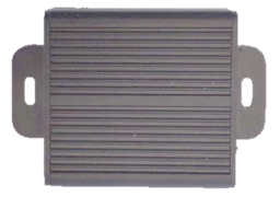
RS-TS5 can achieve 8-channel synchronous trigger signal generation based on external 1PPS or internal clock. The synchronization accuracy is µs level between 8 channels, and between 8-channel and the external 1PPS. When the external 1PPS is invalid, it can automatically switch to the external reference. The 8 channels’ parameter can be configured separately through the serial port, including output frequency, output duty cycle, and output effective level.
Features:
- •High synchronization accuracy and low synchronization delay
- •Input and output pulse parameters can be configured through the serial port
- •Support 8-channel signal synchronization at the same time
- •Support internal and external pulse triggering at the same time, and automatically switch to internal pulse triggering when there is no external pulse
- •Low frequency error, error < 10ppm
- •Synchronization accuracy <5us
Integrated navigation and external synchronization module and integrated navigation base station(RS-INTS1、RS-INTB1)
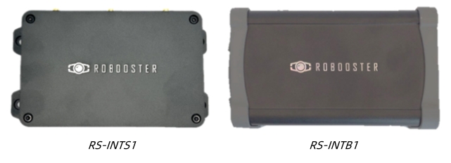
The RS-INTS1 integrated navigation and external synchronization module built-in dual antenna differential GNSS module, 3-axis gyroscope, 3-axis accelerometer, 3-axis magnetometer and barometer. The internal sensor sampling is strictly synchronized with 1PPS. At the same time, taking 1PPS of GNSS as input, it can generate and output up to 6 synchronization signals synchronized with 1PPS according to the frequency configured by the user, which is used to provide trigger signals to other users' equipment. The frequency and duty cycle of 6 synchronization signals can be configured separately. The integrated navigation and external synchronization module is internally integrated with a 4G module, which is paired with the RS-INTB1 integrated navigation base station module. When powered on, it automatically communicates with the integrated navigation base station module to achieve high-precision RTK Positioning. The dual antenna differential GNSS module can provide users with high-precision azimuth output at the same time. RS-INTS1 also supports RTK of QianXun data without complex operation. After the client enters the QianXun account, it can be “ONE-Touch RTK”.
Features:
- •Build-in dual antenna differential GNSS module
- •Build-in high-performance MEMS-IMU
- •Build-in 3-axis magnetometer and barometer
- •Internal sensor data acquisition is fully synchronized with 1PPS
- •6-channel synchronous trigger signal output
- •Synchronization signal frequency, trigger offset, effective level, duty cycle and other parameters can be configured independently
- •External second pulse / internal second pulse mode
- •ROS drive available
Multi-source fusion synchronous acquisition device(RS-SLAMBase/RS-SLAMBasePro)
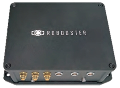
The multi-source fusion synchronous acquisition device uses a high-performance ARM multi-core processor, which integrates a dual antenna differential GNSS module, a 3-axis gyroscope, a 3-axis MEMS accelerometer, a 3-axis magnetometer, and a barometer. The internal sensor sampling is synchronized with 1PPS. At the same time, 1PPS of GNSS is used as an input. According to the frequency configured by the user, it can generate and output up to four synchronization signals synchronized with 1PPS, which are used to provide trigger signals to other sensors of the user. It is an ideal synchronous acquisition platform for SLAM and 3D reconstruction research.
Features:
- •All sensor data is synchronized via 1PPS signal by hardware, and can be synchronized via built-in trigger signal even without GNSS signal
- •Base station differential data or Qianxun search data input to achieve dual antenna RTK Positioning
- •4-channel synchronous trigger signal output, which can trigger other sensors provided by user.
- •Synchronization signal frequency, trigger offset, effective level, duty cycle and other parameters can be configured independently
- •Integrated 4G communication, one touch RTK Positioning (optional paired base station)
Multi-source fusion positioning & mapping equipment(RS-SLAMPlus/RS-SLAMPlusPro)
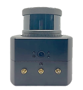
SLAMPlus is a high-integration high-performance sensing device, which integrates advanced sensor technology and time synchronization mechanism. The device is internally integrated with a four eye panoramic camera, a LiDAR, a dual antenna differential GNSS module, a 3-axis gyroscope, a 3-axis MEMS accelerometer, a 3-axis magnetometer, and a barometer. The internal sensor sampling is strictly synchronized with 1PPS (pulse per second). The output of All sensor data are from ROS nodes, and all data interfaces use buckle connectors, which is more suitable for mobile carriers. Slam plus provides a powerful plug and play solution for researchers of multi-sensor fusion, slam, 3D modeling of Surveying and mapping and full source fusion navigation. It is today's leading development platform for perceptual measurement and multi-source fusion navigation.
Features:
- •Integrated a 3D LiDAR
- •Built-in 4-eye panoramic camera;
- •Built-in dual antenna differential GNSS module;
- •Built-in high-performance MEMS-IMU;
- •Built-in 3-axis magnetometer and barometer;
- •Internal sensor data acquisition is fully synchronized with 1pps;
- •Output all sensor raw data collected synchronously;
- •Included 4G Network, one touch RTK positioning (optional paired base station)

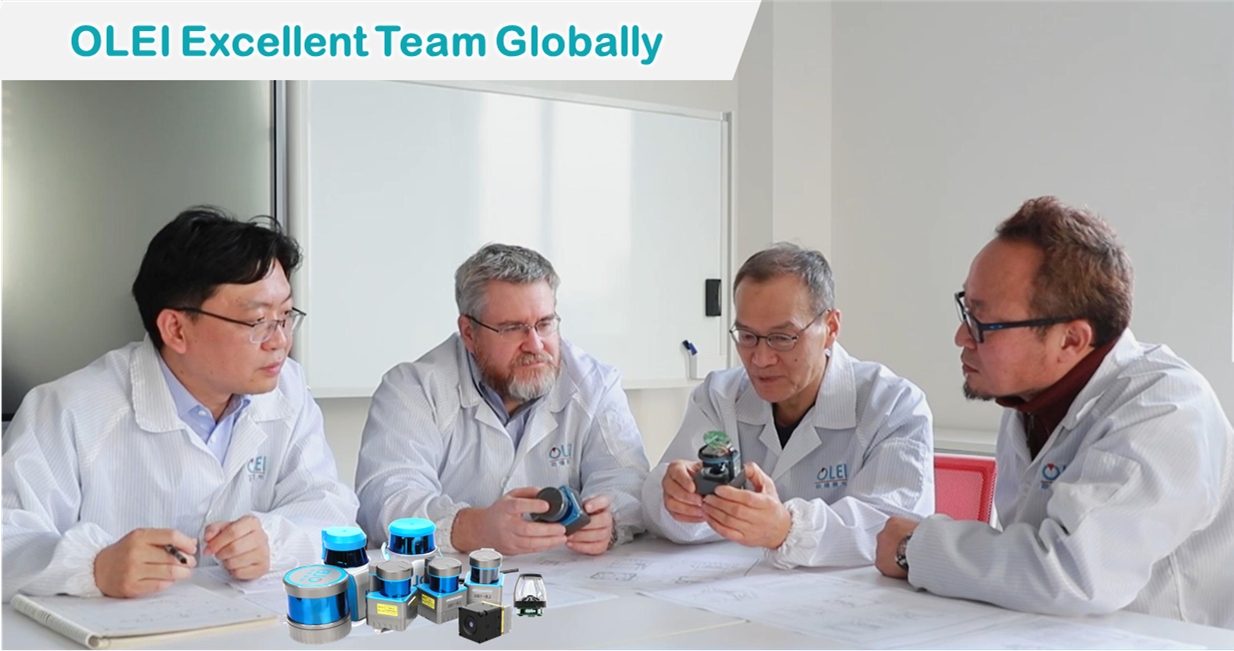
OLEI Profile:
- ● OLEI was established in 2016 Hangzhou. It is a holding subsidiary of Greatstar technology (Stock code SZ002444). OLEI plays the role of design, R&D and manufacturing of core optoelectronic devices under Greatstar group.
- ● OLEI has about 90 professional members with experience in the optical, mechanical, electrical and surveying and mapping instrument; and has an experienced and stable team in Manufacturing & Engineering.
Products
OLEI provides 1D, 2D, 3D LiDAR for navigation, positioning and obstacle avoidance for industrial and commercial level mobile robots.
A090/A200 1D Laser Ranging Sensor
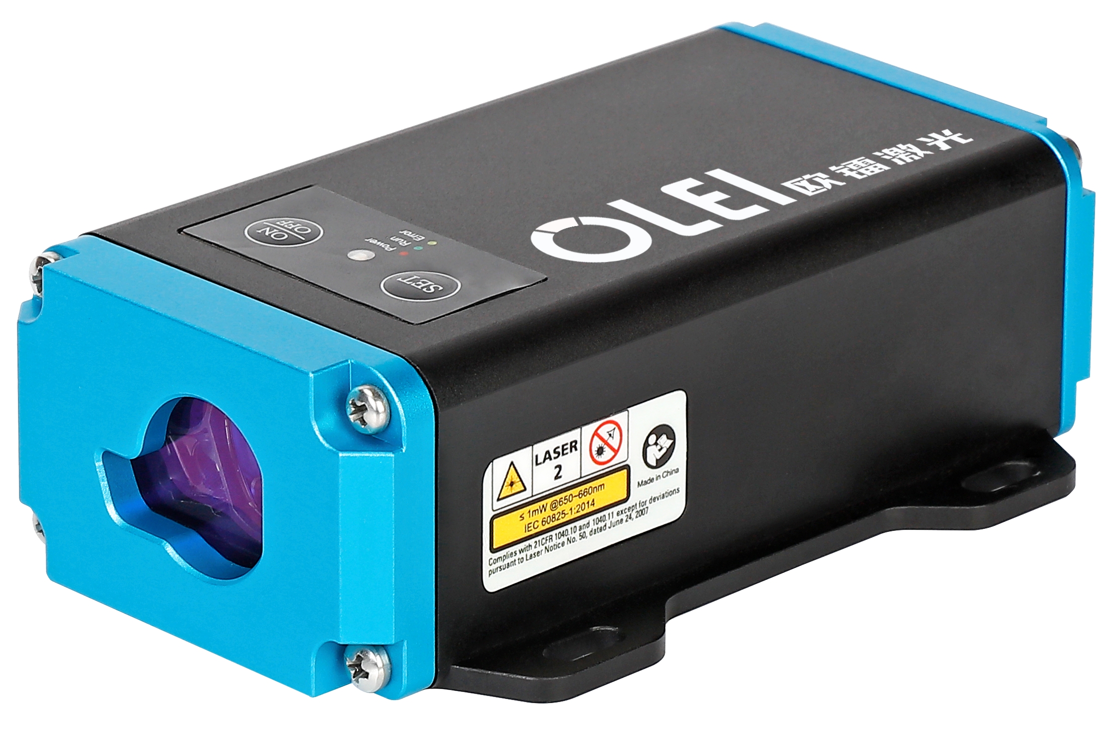
Features:
- ● Range: 0.05-90/200m (Natural target), 2 Ver. optional
- ● Range resolution: 0.1mm
- ● Frequency: up to 30Hz
- ● Ambient light limit: <30klux
- ● Interfaces: RS485, CAN, analog,1 switch input, 2 switch outputs
- ● Working temperature: -20~+55℃
Applications:
- ● Container positioning
- ● Positioning trolleys and translation carts
- ● Water level measurement of rivers and lakes
- ● Collision Monitoring of cranes/gantry cranes
- ● Positioning of large workpieces during Assembly
- ● Length measurement during material cutting
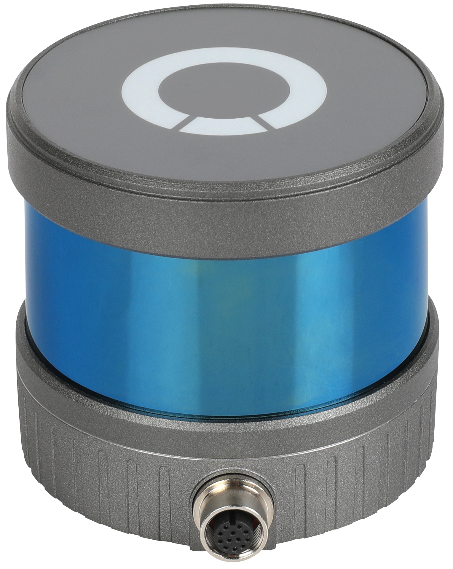
LR-1BS2 2D LiDAR Sensor
Features:
- ● Obstacle avoidance LiDAR with excellent cost performance
- ● Suitable for obstacle avoidance and safety area protection, with detection capability up to 20m
- ● Switching output with point cloud data
- (Through PLC or point cloud data)
- ● ±0.5° horizontal angle accuracy
- ● Safe area can be set freely, 16-bank.3-level protection
- ● ROS Driver available
- ● Certification: FCC, EMC, CE, RoHS, REACH, FDA
- ● Protection level: IP66
Applications:
 |
|
 |
|
 |
|
 |
| Autonomous Mobile Robot(AMR) |
|
Industrial Automation |
|
Active Safety Monitoring |
|
Intelligent Logistics |
|
LR-1BS5 2D LiDAR Sensor

Features:
- ● Suitable for SLAM navigation and point cloud obstacle avoidance strategies
- ● Ranging: 25m @ (R=80%), 30m optional
- ● Scanning range: Horizontal angle= 270 °, 0.225 ° fixed angle resolution
- ● Horizontal plane error: ±0.5°
- ● User-settable weak signal threshold strength adjustment to cope with different usage scenarios
- ● Built-in multi-level filtering algorithm, customers can set as needed to deal with tailing problems
- ● ROS Driver available
- ● Maximum point cloud density is 40k/s: Provide azimuth, distance, reflection intensity and other data
- ● Certification: FCC, EMC, CE, RoHS, REACH
- ● IP66 Protection Level
Applications:
|
|
|
|
|
|
|
| Autonomous Mobile Robot(AMR) |
|
Industrial Automation |
|
Active Safety Monitoring |
|
Intelligent Logistics |
|
VF1-25 2D LiDAR Sensor
Features:
- ● Applicable to SLAM navigation and point cloud obstacle avoidance
- ● Ranging: 25m @ (R=80%), >8m @ (R=4%),40m optional
- ● Scanning range: field angle (horizontal) 360 °, 0.25 ° angular resolution @ 10Hz
- ● 2 Options: Data type and switch output
- ● Patented light path design, which can enhance the use ability under the rainwater and pollution of Ring lens
- ● Ambient light limit ≤ 120K Lux;
- ● ESD level reaches Level 4 (EN IEC 61000-4-2:2009) 8KV contact discharge; 15KV air discharge;
- ● Protection grade: IP67
Applications:
|
|
|
|
|
|
|
| Autonomous Mobile Robot(AMR) |
|
Industrial Automation |
|
Active Safety Monitoring |
|
Intelligent Logistics |
|
LR-1F 2D LiDAR Sensor
Features:
- ● Compatible with reflector navigation and natural navigation, and suitable for application requirements of hybrid navigation
- ● 360° full-angle scanning, up to 50m,Angular resolution up to 0.06°
- ● Horizontal plane error±0.5°to ensure horizontal scanning distance
- ● 60k/s point cloud density, Output data: Azimuth, distance, reflection strength
- ● Highly reliable motor design: cope with high-speed and bumpy operating environments
- ● Certifications: FCC,EMC,CE,RoHS,REACH,FDA
- ● IP66 Protection Level
Applications:
|
|
|
|
|
|
|
| Autonomous Mobile Robot(AMR) |
|
Industrial Automation |
|
Active Safety Monitoring |
|
Intelligent Logistics |
|
GS1-5 SIL2 Safety LiDAR Sensor
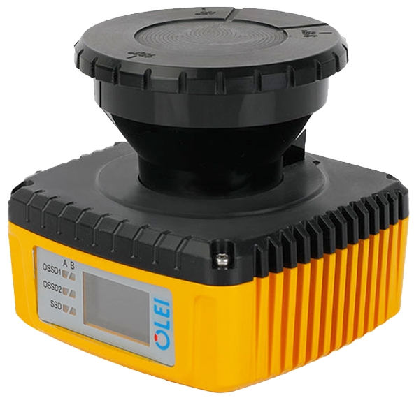
Features:
- ● Detection capability: the maximum safety protection distance is 5m, the maximum warning area is 20m, and the minimum detection object diameter is ≥ 20mm
- ● GS1-5 can be freely configured in up to 32 banks with the use of OLEI configuration software
- ● Comply with IEC61508/IEC62061 SIL2 safety level standard
- ● Comply with ISO13849 PLd safety level standard
- ● Comply with IEC61496 Type 3 safety performance requirements
- ● Comply with IEC60825 Class 1 laser safety level standard
- ● ESD level: reaching Level 4 (IEC61000-4-2) 8KV contact discharge, 15K air discharge
- ● Protection grade: IP65
- ● Scheduled launch time: July 2024
Applications:
|
|
|
|
|
|
|
| Autonomous Mobile Robot(AMR) |
|
Industrial Automation |
|
Active Safety Monitoring |
|
Intelligent Logistics |
|
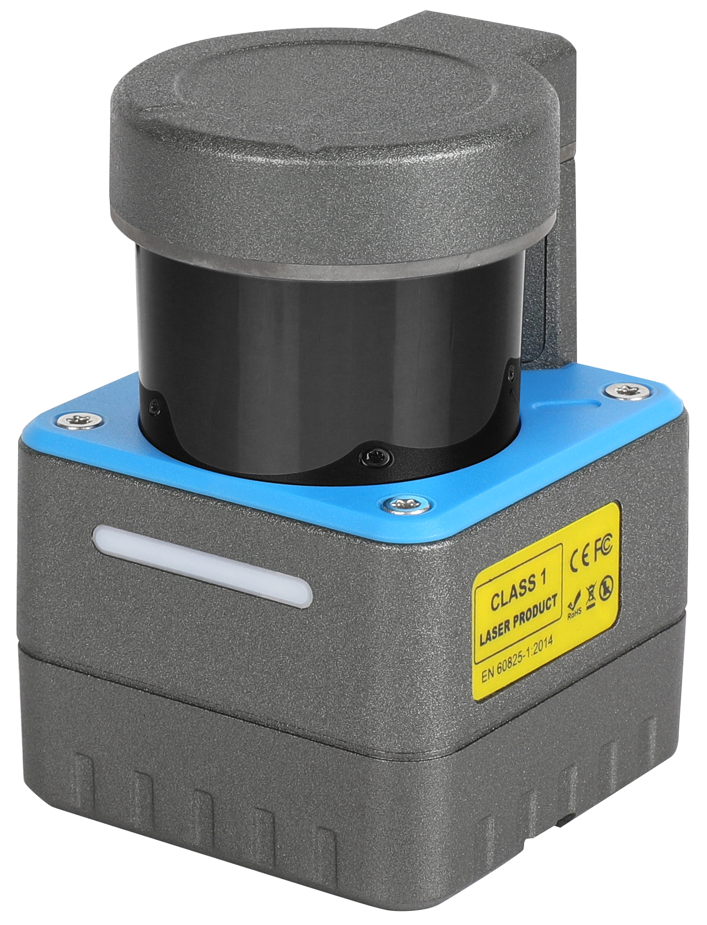
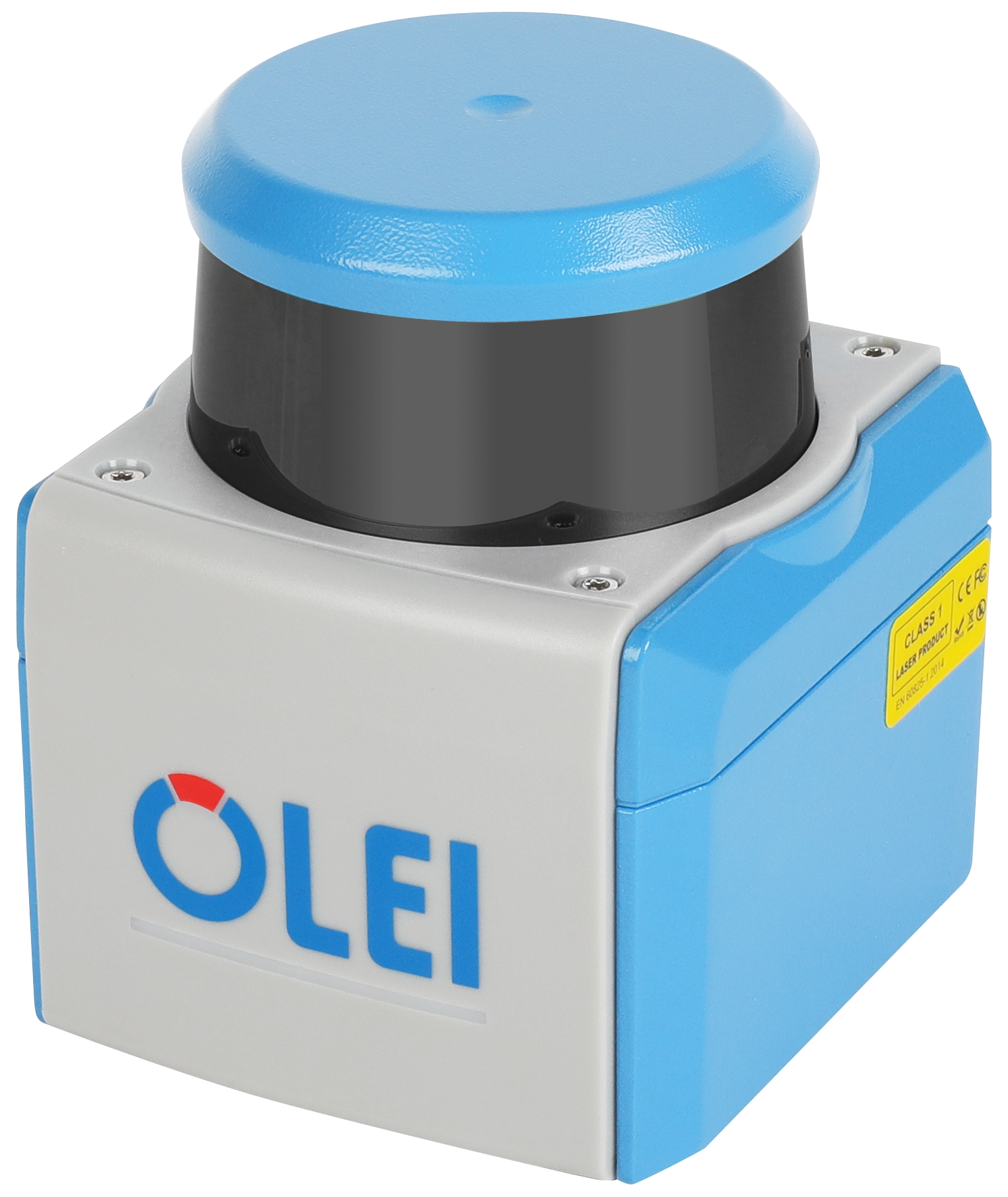
LR-16F 3D LiDAR Sensor
Features:
- ● Design for natural navigation of mobile robots and mobile mapping MMS
- ● Ranging capacity: 100m @ (R=80%)
- ● Scanning range:
- ● Horizontal: field angle 360 °, resolution 0.18 °± 10% @ 10Hz
- ● Vertical: field angle ± 15 °, resolution 2 ° ± 0.1 °
- ● 310K/s point cloud density: provide the data of azimuth, distance, reflection intensity
- ● Compact size: 97 (D) × 85.2 (H) (mm)
- ● Innovative optical design, high product consistency
- ● OLEI patented heat dissipation design, with high stability and excellent high and low temperature accuracy
- ● Customization is acceptable: number of lines (4~16), outlet mode, explosion-proof, protection grade
- ● Certification: FCC, EMC, CE, RoHS, REACH
- ● Protection grade: IP66
应用:
|
|
|
|
|
|
|
|
 |
| Autonomous Mobile Robot(AMR) |
|
Industrial Automation |
|
Active Safety Monitoring |
|
Intelligent Logistics |
|
Mobile surveying and mapping |
|

LightIC Technologies was founded in 2019, headquartered in Beijing. LightIC focus on development and manufacturing of FMCW LiDAR chips and systems based on our proprietary Silicon Photonics technology. We also focus on the R&D of the next-generation, all-solid-state FMCW LiDAR.
FMCW LiDAR is widely used in automobile, UAV navigation, industrial automation, aerospace and other fields due to its advantages of strong anti-interference, low power consumption and high-precision range and speed measurement.
LightIC has successfully launched the FMCW dynamic instantaneous LiDAR system-LARK.
Core Advantages of LARK FMCW LiDAR:
- 1. Instant Velocity Detection
Provide advanced detection and perception capabilities.
- 2. Wide Velocity Range: -240km/h to 240km/h
The speed measurement range covers more detection objects and intelligently distinguishes moving targets in the opposite direction
- 3. Immunity to Interference of Light source
No performance degradation in direct Sunlight or with other LiDARs.
- 4. Ultra-Slim Body: 46mm thickness
Higher space adaptability
- 5. 1v1 pair identification anti-interference
Fearless against other active LiDAR
- 6. High Velocity Precision: 0.05m/s
Detect and discriminate moving targets from static background with high precision.
- 7. Dynamic ROI switching
Accurate real-time positioning and tracking of moving targets
- 8. 230m@10 %Long range detection
More response time for decision making beyond the human eye's fine observation distance
Specifications:
| Item |
Specification |
| Laser Class |
Class 1 |
| Detection Range |
1~300m (200m @10%) |
| Range Accuracy 1σ |
3cm |
| Velocity Range |
-240~240km/h |
| Velocity Accuracy |
0.05 m/s |
| Blind Range |
~0.5m |
| FOV(H) |
120° |
| FOV(H) Angle Resolution |
0.1° |
| FOV(V) |
25° |
| Min. Angle(V) Resolution |
0.08° |
| Angle accuracy |
0.05° |
| Frame rate (fps) |
~10Hz |
| Return Mode |
Support Single return and dual returns |
| Data Rate |
1.5M/s(Single return),3M/s(Dual returns) |
| Data Connection |
1000Mbps Ethernet over UDP connection |
| Time synchronization |
PTP |
Size
W*D*H(mm): |
206mm x 140mm x 46mm |
| Weight |
1.9 Kg |
| Data Contents |
Timestamp, point location information, speed, reflectivity |
| Power Input |
DC 9-32V |
| Power consumption |
~90W |
| Protection Level |
IP67 |
| Operation Temperature |
-20~65℃ |

With the advantages of long detecting range, high anti ambient light capability and suitable for mass production, Toffuture’s flash LiDAR can bring high efficient sensory power to automobile, robot, IoT, security system and so on, making human life more efficient and comfortable.
Features:
- • All-Solid-State Design: No moving mechanical parts for superiordurability and wear resistance
- • Automotive-Grade Reliability: Manufactured using mature silicon-based semiconductor technology, ensuring high consistency, stability, robust-ness,and ultra-low failure rate
- • Optimized for Mass Production: High integration, simplified structures
Applications:
 |
 |
 |
| Volume measurement |
Access control/Security |
Robotics |
| |
|
|
 |
 |
 |
| Assisted driving |
Smart Road |
Unmanned vehicle |
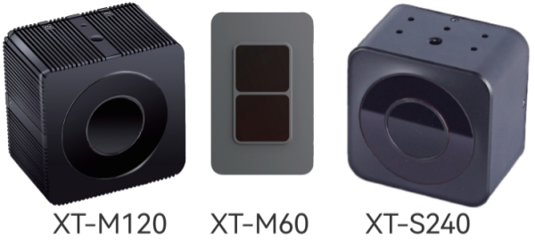
| Product Name |
S-Series - Industrial Grade |
| XT-S240 Mini |
XT-S240 Pro |
| Scenario |
Low Speed |
| FOV |
106° × 80° |
72° × 58° |
| Wavelength (nm) |
940 nm |
| Average Power (W) |
6 W |
| Output Data |
3D Point Cloud, Depth Image, Reflectance Map, Grayscale Image |
| SDK |
C++ / Python / Linux / Ros1 & Ros2 |
| Accuracy |
1% - 2% |
| Angular Resolution |
0.33°(H) × 0.33°(V) |
0.22°(H) × 0.24°(V) |
| Detect Range |
320 × 240 |
Testing Distance
@ 50% Reflectivity |
10 m Outdoor |
15 m Outdoor |
| Frame Rate(FPS) |
10 - 20 |
| Size(mm) |
68 × 68 × 45 |
| Weight |
198 g |
192 g |
| Voltage |
12 - 24V(DC) @ 3A |
| Working Temperature |
-20° to +60° |
| Product Name |
M-Series - Automotive Grade |
| XT-M120 Mini |
XT-M120 Pro |
XM-M120 Max |
XT-M60 |
| Scenario |
Medium Speed |
Medium-High Speed |
Vehicle Blind Spot Coverage
(Low-Medium Speed)
|
| FOV |
106° × 80° |
72° × 58° |
32° × 24° |
120° × 45° |
| Wavelength (nm) |
940 nm |
| Average Power (W) |
12 W |
6 W |
| Output Data |
3D Point Cloud, Depth Image, Reflectance Map, Grayscale Image |
| SDK |
C++ / Python / Linux / Ros1 & Ros2 |
| Accuracy |
1% - 2% |
| Angular Resolution |
0.33°(H) × 0.66°(V) |
0.22°(H) × 0.48°(V) |
0.1°(H) × 0.2°(V) |
0.75°(H) × 0.75°(V) |
| Detect Range |
320 × 120
|
160 × 60 |
Testing Distance
@ 50% Reflectivity |
20 m Outdoor |
30 m Outdoor
|
80 m Outdoor
|
15 m Outdoor
|
| Frame Rate(FPS) |
10 - 50
|
1 - 30 |
| Size(mm) |
72 × 72 × 48
|
65 × 35 × 45
|
| Weight |
220 g
|
123 g |
| Voltage |
12 - 24V(DC) @ 3A 航空接口
|
12 - 24V(DC) @ 3A |
| Working Temperature |
-40° to +85°
|
Remark:
- 1. The measurement range changes with the variation of frequency, intensity, and the target reflectivity.
- 2. Support single and continuous transmission measurement with the frequency at 5HZ, 10Hz, 20Hz, and 30Hz.
- * The products, their specifications and other information appearing in this document are subject to change by A&P without notice.
A&P Instrument provides 2D and 3D LiDAR based on ToF, FMCW, and FLASH technologies to meet the needs of mobile robots and AI for various applications. At the same time, we also offer a Localization Computation Unit that delivers continuous and stable pose information, assist agile development for a wide range of mobile robotic systems in faster way.
Robooster - Assist in Development of Mobile Robot Systems in faster way
Powered by Robooster’s proprietary multi-sensor time synchronization architecture and multi-source data fusion technology, we offer modular positioning solutions for diverse application scenarios, including:
- •LCU (Localization & Computing Unit): A multi-source fusion positioning module with pose data output
- •NIPC (Navigation Industrial PC): A series of open-source industrial computers for specialized navigation applications
- •SLAM-DP Development Platform: A plug-and-play, spatiotemporal fusion platform for agile development
OLEI Lasers – 2D and 3D ToF LiDAR
OLEI Lasers provides 1D, 2D, and 3D LiDAR for navigation, positioning, and obstacle avoidance in industrial and commercial mobile robots.
LightIC – FMCW 3D LiDAR
Photonics integration technology dedicated to the R&D and production of LiDAR chips and systems based on silicon photonics technology. With proprietary intellectual property, LightIC focuses on the development and mass production of next-generation FMCW LiDAR.
ToFFuture – Flash 3D LiDAR
ToFFuture's Flash LiDAR boasts long-range measurement capabilities, strong anti-interference performance, and design for mass production, enabling more efficient perception for industries such as vehicles, robots, IoT, and security.
Sino-German Robooster Intelligent Technology Co. Ltd (SGR)
Robooster was founded by PhD graduated from Germany in the field of robotics and navigation positioning in 2015. Adhering to the craftsmanship spirit of "Rigor, Patience, Professional, Continuous Improvement", Robooster aims to become a leading global provider of all scenario positioning solutions with the vision of "Find a Way for AI". The team has been deeply involved in mobile robots and autonomous mobile solutions for many years, focusing on research and innovation in the fields of multi-sensors fusion, full source fusion positioning, robot motion control, and mobile carrier motion measurement. It integrates industry awareness, core technology, mass production, and supply chain advantages.
Products:
Time Synchronizer (RS-TS5)
RS-TS5 can achieve 8-channel synchronous trigger signal generation based on external 1PPS or internal clock. The synchronization accuracy is µs level between 8 channels, and between 8-channel and the external 1PPS. When the external 1PPS is invalid, it can automatically switch to the external reference. The 8 channels’ parameter can be configured separately through the serial port, including output frequency, output duty cycle, and output effective level.
Features:
- •High synchronization accuracy and low synchronization delay
- •Input and output pulse parameters can be configured through the serial port
- •Support 8-channel signal synchronization at the same time
- •Support internal and external pulse triggering at the same time, and automatically switch to internal pulse triggering when there is no external pulse
- •Low frequency error, error < 10ppm
- •Synchronization accuracy <5us
Integrated navigation and external synchronization module and integrated navigation base station(RS-INTS1、RS-INTB1)
The RS-INTS1 integrated navigation and external synchronization module built-in dual antenna differential GNSS module, 3-axis gyroscope, 3-axis accelerometer, 3-axis magnetometer and barometer. The internal sensor sampling is strictly synchronized with 1PPS. At the same time, taking 1PPS of GNSS as input, it can generate and output up to 6 synchronization signals synchronized with 1PPS according to the frequency configured by the user, which is used to provide trigger signals to other users' equipment. The frequency and duty cycle of 6 synchronization signals can be configured separately. The integrated navigation and external synchronization module is internally integrated with a 4G module, which is paired with the RS-INTB1 integrated navigation base station module. When powered on, it automatically communicates with the integrated navigation base station module to achieve high-precision RTK Positioning. The dual antenna differential GNSS module can provide users with high-precision azimuth output at the same time. RS-INTS1 also supports RTK of QianXun data without complex operation. After the client enters the QianXun account, it can be “ONE-Touch RTK”.
Features:
- •Build-in dual antenna differential GNSS module
- •Build-in high-performance MEMS-IMU
- •Build-in 3-axis magnetometer and barometer
- •Internal sensor data acquisition is fully synchronized with 1PPS
- •6-channel synchronous trigger signal output
- •Synchronization signal frequency, trigger offset, effective level, duty cycle and other parameters can be configured independently
- •External second pulse / internal second pulse mode
- •ROS drive available
Multi-source fusion synchronous acquisition device(RS-SLAMBase/RS-SLAMBasePro)
The multi-source fusion synchronous acquisition device uses a high-performance ARM multi-core processor, which integrates a dual antenna differential GNSS module, a 3-axis gyroscope, a 3-axis MEMS accelerometer, a 3-axis magnetometer, and a barometer. The internal sensor sampling is synchronized with 1PPS. At the same time, 1PPS of GNSS is used as an input. According to the frequency configured by the user, it can generate and output up to four synchronization signals synchronized with 1PPS, which are used to provide trigger signals to other sensors of the user. It is an ideal synchronous acquisition platform for SLAM and 3D reconstruction research.
Features:
- •All sensor data is synchronized via 1PPS signal by hardware, and can be synchronized via built-in trigger signal even without GNSS signal
- •Base station differential data or Qianxun search data input to achieve dual antenna RTK Positioning
- •4-channel synchronous trigger signal output, which can trigger other sensors provided by user.
- •Synchronization signal frequency, trigger offset, effective level, duty cycle and other parameters can be configured independently
- •Integrated 4G communication, one touch RTK Positioning (optional paired base station)
Multi-source fusion positioning & mapping equipment(RS-SLAMPlus/RS-SLAMPlusPro)
SLAMPlus is a high-integration high-performance sensing device, which integrates advanced sensor technology and time synchronization mechanism. The device is internally integrated with a four eye panoramic camera, a LiDAR, a dual antenna differential GNSS module, a 3-axis gyroscope, a 3-axis MEMS accelerometer, a 3-axis magnetometer, and a barometer. The internal sensor sampling is strictly synchronized with 1PPS (pulse per second). The output of All sensor data are from ROS nodes, and all data interfaces use buckle connectors, which is more suitable for mobile carriers. Slam plus provides a powerful plug and play solution for researchers of multi-sensor fusion, slam, 3D modeling of Surveying and mapping and full source fusion navigation. It is today's leading development platform for perceptual measurement and multi-source fusion navigation.
Features:
- •Integrated a 3D LiDAR
- •Built-in 4-eye panoramic camera;
- •Built-in dual antenna differential GNSS module;
- •Built-in high-performance MEMS-IMU;
- •Built-in 3-axis magnetometer and barometer;
- •Internal sensor data acquisition is fully synchronized with 1pps;
- •Output all sensor raw data collected synchronously;
- •Included 4G Network, one touch RTK positioning (optional paired base station)
OLEI Profile:
- ● OLEI was established in 2016 Hangzhou. It is a holding subsidiary of Greatstar technology (Stock code SZ002444). OLEI plays the role of design, R&D and manufacturing of core optoelectronic devices under Greatstar group.
- ● OLEI has about 90 professional members with experience in the optical, mechanical, electrical and surveying and mapping instrument; and has an experienced and stable team in Manufacturing & Engineering.
Products
OLEI provides 1D, 2D, 3D LiDAR for navigation, positioning and obstacle avoidance for industrial and commercial level mobile robots.
A090/A200 1D Laser Ranging Sensor
Features:
- ● Range: 0.05-90/200m (Natural target), 2 Ver. optional
- ● Range resolution: 0.1mm
- ● Frequency: up to 30Hz
- ● Ambient light limit: <30klux
- ● Interfaces: RS485, CAN, analog,1 switch input, 2 switch outputs
- ● Working temperature: -20~+55℃
Applications:
- ● Container positioning
- ● Positioning trolleys and translation carts
- ● Water level measurement of rivers and lakes
- ● Collision Monitoring of cranes/gantry cranes
- ● Positioning of large workpieces during Assembly
- ● Length measurement during material cutting
LR-1BS2 2D LiDAR Sensor
Features:
- ● Obstacle avoidance LiDAR with excellent cost performance
- ● Suitable for obstacle avoidance and safety area protection, with detection capability up to 20m
- ● Switching output with point cloud data
- (Through PLC or point cloud data)
- ● ±0.5° horizontal angle accuracy
- ● Safe area can be set freely, 16-bank.3-level protection
- ● ROS Driver available
- ● Certification: FCC, EMC, CE, RoHS, REACH, FDA
- ● Protection level: IP66
Applications:
|
|
|
|
|
|
|
| Autonomous Mobile Robot(AMR) |
|
Industrial Automation |
|
Active Safety Monitoring |
|
Intelligent Logistics |
|
LR-1BS5 2D LiDAR Sensor
Features:
- ● Suitable for SLAM navigation and point cloud obstacle avoidance strategies
- ● Ranging: 25m @ (R=80%), 30m optional
- ● Scanning range: Horizontal angle= 270 °, 0.225 ° fixed angle resolution
- ● Horizontal plane error: ±0.5°
- ● User-settable weak signal threshold strength adjustment to cope with different usage scenarios
- ● Built-in multi-level filtering algorithm, customers can set as needed to deal with tailing problems
- ● ROS Driver available
- ● Maximum point cloud density is 40k/s: Provide azimuth, distance, reflection intensity and other data
- ● Certification: FCC, EMC, CE, RoHS, REACH
- ● IP66 Protection Level
Applications:
|
|
|
|
|
|
|
| Autonomous Mobile Robot(AMR) |
|
Industrial Automation |
|
Active Safety Monitoring |
|
Intelligent Logistics |
|
VF1-25 2D LiDAR Sensor
Features:
- ● Applicable to SLAM navigation and point cloud obstacle avoidance
- ● Ranging: 25m @ (R=80%), >8m @ (R=4%),40m optional
- ● Scanning range: field angle (horizontal) 360 °, 0.25 ° angular resolution @ 10Hz
- ● 2 Options: Data type and switch output
- ● Patented light path design, which can enhance the use ability under the rainwater and pollution of Ring lens
- ● Ambient light limit ≤ 120K Lux;
- ● ESD level reaches Level 4 (EN IEC 61000-4-2:2009) 8KV contact discharge; 15KV air discharge;
- ● Protection grade: IP67
Applications:
|
|
|
|
|
|
|
| Autonomous Mobile Robot(AMR) |
|
Industrial Automation |
|
Active Safety Monitoring |
|
Intelligent Logistics |
|
LR-1F 2D LiDAR Sensor
Features:
- ● Compatible with reflector navigation and natural navigation, and suitable for application requirements of hybrid navigation
- ● 360° full-angle scanning, up to 50m,Angular resolution up to 0.06°
- ● Horizontal plane error±0.5°to ensure horizontal scanning distance
- ● 60k/s point cloud density, Output data: Azimuth, distance, reflection strength
- ● Highly reliable motor design: cope with high-speed and bumpy operating environments
- ● Certifications: FCC,EMC,CE,RoHS,REACH,FDA
- ● IP66 Protection Level
Applications:
|
|
|
|
|
|
|
| Autonomous Mobile Robot(AMR) |
|
Industrial Automation |
|
Active Safety Monitoring |
|
Intelligent Logistics |
|
GS1-5 SIL2 Safety LiDAR Sensor
Features:
- ● Detection capability: the maximum safety protection distance is 5m, the maximum warning area is 20m, and the minimum detection object diameter is ≥ 20mm
- ● GS1-5 can be freely configured in up to 32 banks with the use of OLEI configuration software
- ● Comply with IEC61508/IEC62061 SIL2 safety level standard
- ● Comply with ISO13849 PLd safety level standard
- ● Comply with IEC61496 Type 3 safety performance requirements
- ● Comply with IEC60825 Class 1 laser safety level standard
- ● ESD level: reaching Level 4 (IEC61000-4-2) 8KV contact discharge, 15K air discharge
- ● Protection grade: IP65
- ● Scheduled launch time: July 2024
Applications:
|
|
|
|
|
|
|
| Autonomous Mobile Robot(AMR) |
|
Industrial Automation |
|
Active Safety Monitoring |
|
Intelligent Logistics |
|
LR-16F 3D LiDAR Sensor
Features:
- ● Design for natural navigation of mobile robots and mobile mapping MMS
- ● Ranging capacity: 100m @ (R=80%)
- ● Scanning range:
- ● Horizontal: field angle 360 °, resolution 0.18 °± 10% @ 10Hz
- ● Vertical: field angle ± 15 °, resolution 2 ° ± 0.1 °
- ● 310K/s point cloud density: provide the data of azimuth, distance, reflection intensity
- ● Compact size: 97 (D) × 85.2 (H) (mm)
- ● Innovative optical design, high product consistency
- ● OLEI patented heat dissipation design, with high stability and excellent high and low temperature accuracy
- ● Customization is acceptable: number of lines (4~16), outlet mode, explosion-proof, protection grade
- ● Certification: FCC, EMC, CE, RoHS, REACH
- ● Protection grade: IP66
应用:
|
|
|
|
|
|
|
|
|
| Autonomous Mobile Robot(AMR) |
|
Industrial Automation |
|
Active Safety Monitoring |
|
Intelligent Logistics |
|
Mobile surveying and mapping |
|
LightIC Technologies was founded in 2019, headquartered in Beijing. LightIC focus on development and manufacturing of FMCW LiDAR chips and systems based on our proprietary Silicon Photonics technology. We also focus on the R&D of the next-generation, all-solid-state FMCW LiDAR.
FMCW LiDAR is widely used in automobile, UAV navigation, industrial automation, aerospace and other fields due to its advantages of strong anti-interference, low power consumption and high-precision range and speed measurement.
LightIC has successfully launched the FMCW dynamic instantaneous LiDAR system-LARK.
Core Advantages of LARK FMCW LiDAR:
- 1. Instant Velocity Detection
Provide advanced detection and perception capabilities.
- 2. Wide Velocity Range: -240km/h to 240km/h
The speed measurement range covers more detection objects and intelligently distinguishes moving targets in the opposite direction
- 3. Immunity to Interference of Light source
No performance degradation in direct Sunlight or with other LiDARs.
- 4. Ultra-Slim Body: 46mm thickness
Higher space adaptability
- 5. 1v1 pair identification anti-interference
Fearless against other active LiDAR
- 6. High Velocity Precision: 0.05m/s
Detect and discriminate moving targets from static background with high precision.
- 7. Dynamic ROI switching
Accurate real-time positioning and tracking of moving targets
- 8. 230m@10 %Long range detection
More response time for decision making beyond the human eye's fine observation distance
Specifications:
| Item |
Specification |
| Laser Class |
Class 1 |
| Detection Range |
1~300m (200m @10%) |
| Range Accuracy 1σ |
3cm |
| Velocity Range |
-240~240km/h |
| Velocity Accuracy |
0.05 m/s |
| Blind Range |
~0.5m |
| FOV(H) |
120° |
| FOV(H) Angle Resolution |
0.1° |
| FOV(V) |
25° |
| Min. Angle(V) Resolution |
0.08° |
| Angle accuracy |
0.05° |
| Frame rate (fps) |
~10Hz |
| Return Mode |
Support Single return and dual returns |
| Data Rate |
1.5M/s(Single return),3M/s(Dual returns) |
| Data Connection |
1000Mbps Ethernet over UDP connection |
| Time synchronization |
PTP |
Size
W*D*H(mm): |
206mm x 140mm x 46mm |
| Weight |
1.9 Kg |
| Data Contents |
Timestamp, point location information, speed, reflectivity |
| Power Input |
DC 9-32V |
| Power consumption |
~90W |
| Protection Level |
IP67 |
| Operation Temperature |
-20~65℃ |
With the advantages of long detecting range, high anti ambient light capability and suitable for mass production, Toffuture’s flash LiDAR can bring high efficient sensory power to automobile, robot, IoT, security system and so on, making human life more efficient and comfortable.
Features:
- • All-Solid-State Design: No moving mechanical parts for superiordurability and wear resistance
- • Automotive-Grade Reliability: Manufactured using mature silicon-based semiconductor technology, ensuring high consistency, stability, robust-ness,and ultra-low failure rate
- • Optimized for Mass Production: High integration, simplified structures
Applications:
|
|
|
| Volume measurement |
Access control/Security |
Robotics |
| |
|
|
|
|
|
| Assisted driving |
Smart Road |
Unmanned vehicle |
| Product Name |
S-Series - Industrial Grade |
| XT-S240 Mini |
XT-S240 Pro |
| Scenario |
Low Speed |
| FOV |
106° × 80° |
72° × 58° |
| Wavelength (nm) |
940 nm |
| Average Power (W) |
6 W |
| Output Data |
3D Point Cloud, Depth Image, Reflectance Map, Grayscale Image |
| SDK |
C++ / Python / Linux / Ros1 & Ros2 |
| Accuracy |
1% - 2% |
| Angular Resolution |
0.33°(H) × 0.33°(V) |
0.22°(H) × 0.24°(V) |
| Detect Range |
320 × 240 |
Testing Distance
@ 50% Reflectivity |
10 m Outdoor |
15 m Outdoor |
| Frame Rate(FPS) |
10 - 20 |
| Size(mm) |
68 × 68 × 45 |
| Weight |
198 g |
192 g |
| Voltage |
12 - 24V(DC) @ 3A |
| Working Temperature |
-20° to +60° |
| Product Name |
M-Series - Automotive Grade |
| XT-M120 Mini |
XT-M120 Pro |
XM-M120 Max |
XT-M60 |
| Scenario |
Medium Speed |
Medium-High Speed |
Vehicle Blind Spot Coverage
(Low-Medium Speed)
|
| FOV |
106° × 80° |
72° × 58° |
32° × 24° |
120° × 45° |
| Wavelength (nm) |
940 nm |
| Average Power (W) |
12 W |
6 W |
| Output Data |
3D Point Cloud, Depth Image, Reflectance Map, Grayscale Image |
| SDK |
C++ / Python / Linux / Ros1 & Ros2 |
| Accuracy |
1% - 2% |
| Angular Resolution |
0.33°(H) × 0.66°(V) |
0.22°(H) × 0.48°(V) |
0.1°(H) × 0.2°(V) |
0.75°(H) × 0.75°(V) |
| Detect Range |
320 × 120
|
160 × 60 |
Testing Distance
@ 50% Reflectivity |
20 m Outdoor |
30 m Outdoor
|
80 m Outdoor
|
15 m Outdoor
|
| Frame Rate(FPS) |
10 - 50
|
1 - 30 |
| Size(mm) |
72 × 72 × 48
|
65 × 35 × 45
|
| Weight |
220 g
|
123 g |
| Voltage |
12 - 24V(DC) @ 3A 航空接口
|
12 - 24V(DC) @ 3A |
| Working Temperature |
-40° to +85°
|
Remark:
- 1. The measurement range changes with the variation of frequency, intensity, and the target reflectivity.
- 2. Support single and continuous transmission measurement with the frequency at 5HZ, 10Hz, 20Hz, and 30Hz.
- * The products, their specifications and other information appearing in this document are subject to change by A&P without notice.